A lake-house centerpiece
Make the shoreline the focus, choose colors that suit the room, and add the name that everyone in the family knows.
 Contour FoundryMAPS FOR MAKING
PRINT & FRAME / Lake posters
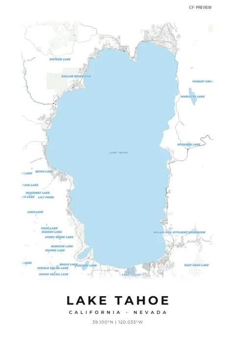
Bring the lake house, a family vacation or your favorite stretch of coast into everyday view. Shape a personalized shoreline print around the water, surrounding roads and places that make it yours.
A custom shoreline print to download, frame and give.
2 credits per finished generation · Free previews · Digital download
START WITH SOMETHING PERSONAL
Make the shoreline the focus, choose colors that suit the room, and add the name that everyone in the family knows.
Create a print of a honeymoon coast, a summer destination or a favorite island, finished with a personal caption.
Turn the place you visit together into a framed thank-you, with your own dedication beneath the map.
INSIDE YOUR DOWNLOAD
A ZIP brings your finished files together. Extract it on your device to use the contents in your software.
Choose JPG for smaller files or PNG for lossless image detail. Your ZIP contains the selected format at full export resolution, with 300 DPI print metadata.
Generate one image in your selected proportion, five images with the largest size for each proportion, or all 15 supplied sizes. Portrait and landscape orientations are available.
PRINTING-NOTES.txt explains the print workflow. START-HERE.txt introduces your package, and design-settings.json records the settings used to create it.
Choose one image in your selected proportion, a five-image collection with the largest size per proportion, or all 15 sizes below. Single-proportion exports use 60 × 90 cm (2:3), 21 × 28 in (3:4), 40 × 50 cm (4:5), 25 × 25 in (square), or A1 (ISO). Use portrait or landscape to suit the shoreline.
| Print proportion | Sizes supplied in the full collection | Ways to frame it |
|---|---|---|
| 2:3 | 16 × 24, 20 × 30, 24 × 36 in; 60 × 90 cm | Tall statement prints; also scales down to 8 × 12 in. |
| 3:4 | 18 × 24, 21 × 28 in | A balanced rectangle; also scales down to 12 × 16 in. |
| 4:5 | 16 × 20, 20 × 25 in; 40 × 50 cm | A classic frame shape; also scales down to 8 × 10 in. |
| Square | 18 × 18, 23 × 23, 25 × 25 in | Gallery walls and matching sets. |
| ISO A | A3, A2, A1 | Standard A-series paper and frames. |
MAKE IT YOURS
Start with the defaults, then adjust the details that matter to you. Help icons explain the settings, and free previews let you review the result before generating finished files.
PUT YOUR FILES TO WORK
Search for a lake or coastal place, or paste exact coordinates. Adjust the area and orientation until the shoreline you care about fits the preview.
Choose your file format and size collection, then confirm Generate files. When it is ready, use Download ZIP and extract the images.
Upload the matching image to your print provider or open it in your printing software. Select the intended size and check the crop. For an exact supplied size, use 100% scale rather than automatically fitting the page.
Choose paper and a frame that suit your room. For smaller prints, check that street names remain readable. Your local print shop can help with paper choice and a proof.
BEFORE YOU CREATE
Yes. Choose a coastal location and adjust the area, orientation and colors around the section of shoreline you want to feature.
This studio shows mapped shorelines and surface features. It is not a bathymetric, depth or boating-navigation chart.
It starts with a water-focused presentation and Lake Blue palette, while retaining the lettering, map-detail and print-size controls. You can make the water prominent or include more of the surrounding community.
A ZIP of the JPG or PNG images you select, printing notes and a record of your design settings. Physical printing, paper and framing are arranged separately.
Explore your settings and generate a free preview. Choose Generate files and confirm the displayed credit cost when you want the finished package. Once generation completes, use Download ZIP. A failed generation returns its reserved credits. Downloading the same completed package again is free while it is available; generating another package uses credits.
START WITH YOUR PLACE
Create an account, verify your email and explore your design. Purchase credits when you are ready to generate finished files.
Create your first map2 credits per finished generation. Software, machines, materials, printing and physical delivery are not included.